Maps Page on Spain
Outline
- Physical Environment
- Weather & Climate
- Human Environment
- Road maps
- City Maps
- Urban Transportation Maps
- Tourist Maps
- Map from Travel Book
1 Physical
Environment
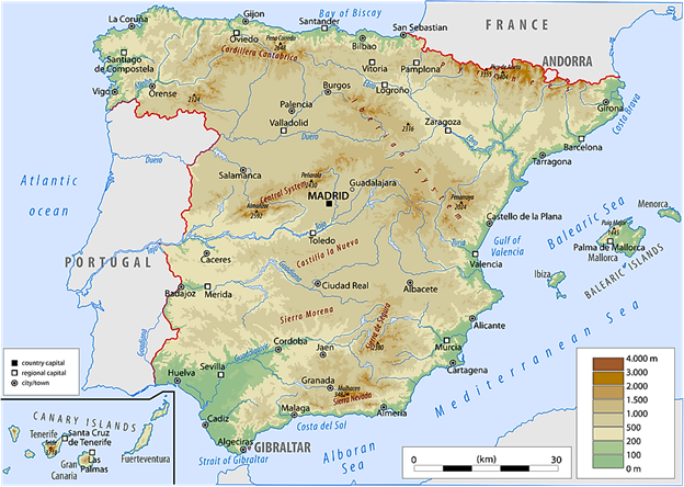
This map shows the elevation
of the different parts of Spain.
https://www.worldatlas.com/r/h600/img/country/spain/physical.png
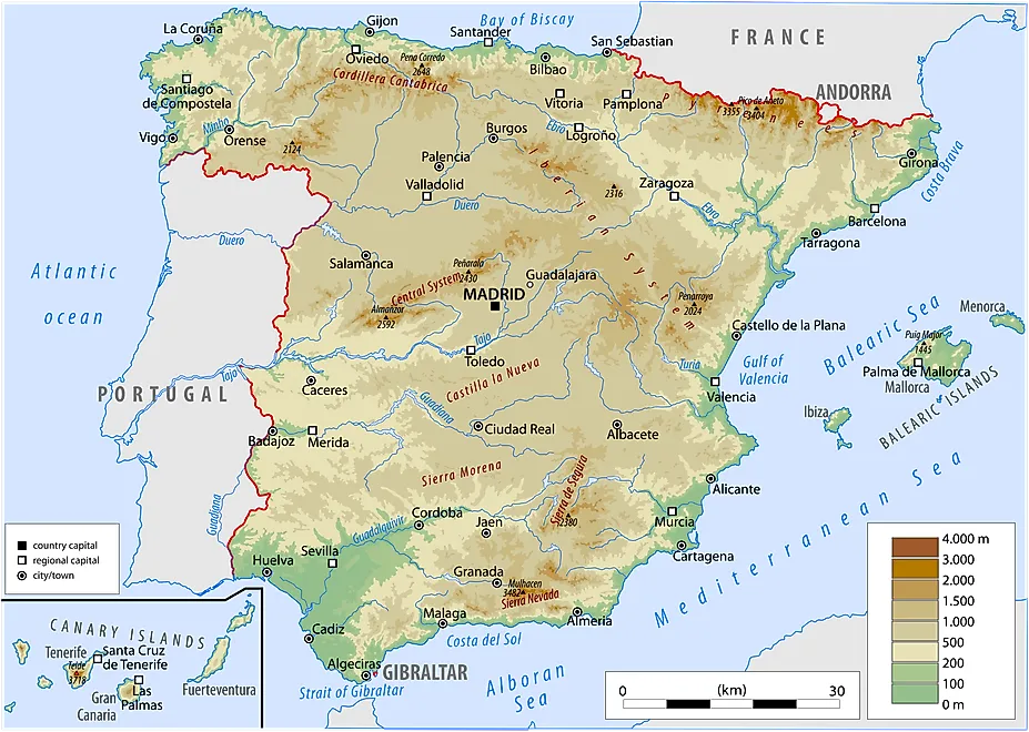
Here is one with more detail
in roads and cities.
https://spainmap360.com/img/0/spain-physical-map.jpg
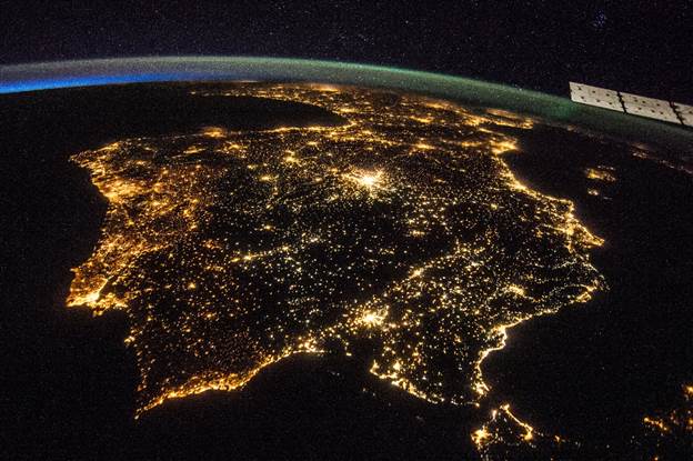
This last one is not a map, but
it is a photo by Nasa of Spain at night which shows where all of the light is
indicating civilization. I find it a striking picture.
https://www.nasa.gov/sites/default/files/thumbnails/image/14797031062_4cbe0f218f_o.jpg
2 Weather &
Climate

The first map I chose for
this section is a map of the average annual temperature in each province.
https://i.redd.it/nmegu2v1g1c01.png
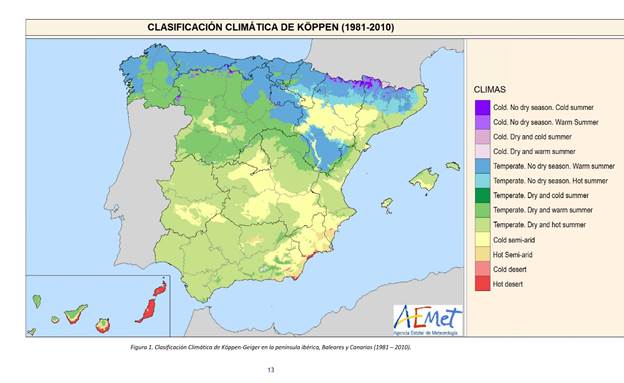
The following is a map
depicting the different climates in Spain.
https://pbs.twimg.com/media/EWWPVccU8AEkRPh.jpg
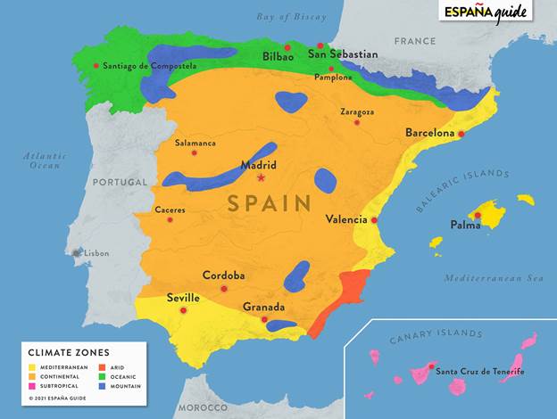
Another climate map because I
needed one more.
https://www.espanaguide.com/images/maps/map-spain-climate-with-cities.jpg
3 Human Environment
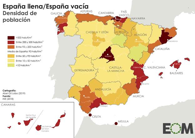
I picked this map to show the
population density of the different regions of Spain.
https://preview.redd.it/yahm3dmp0dd71.png?auto=webp&s=748a91e7aab662139c1a288d6b40de769afb6c61
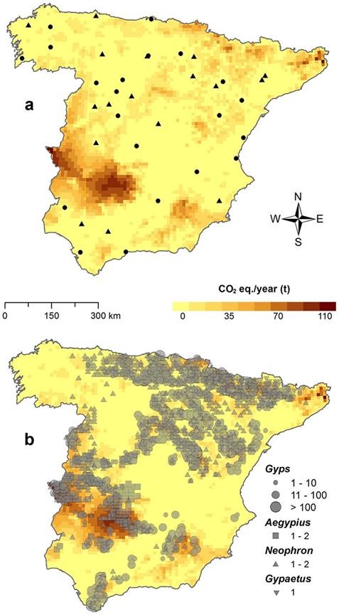
This map shows the estimated
carbon emissions in Spain.
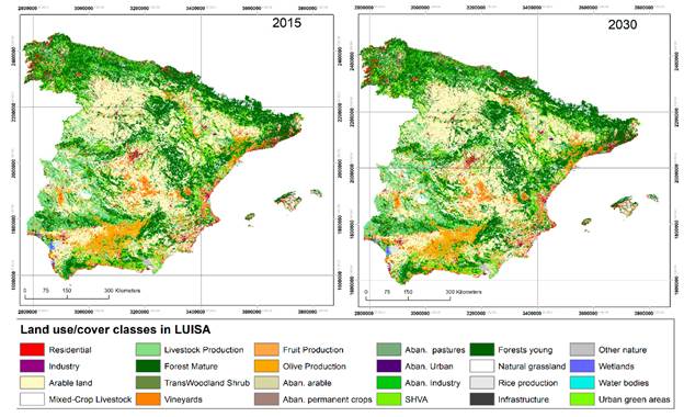
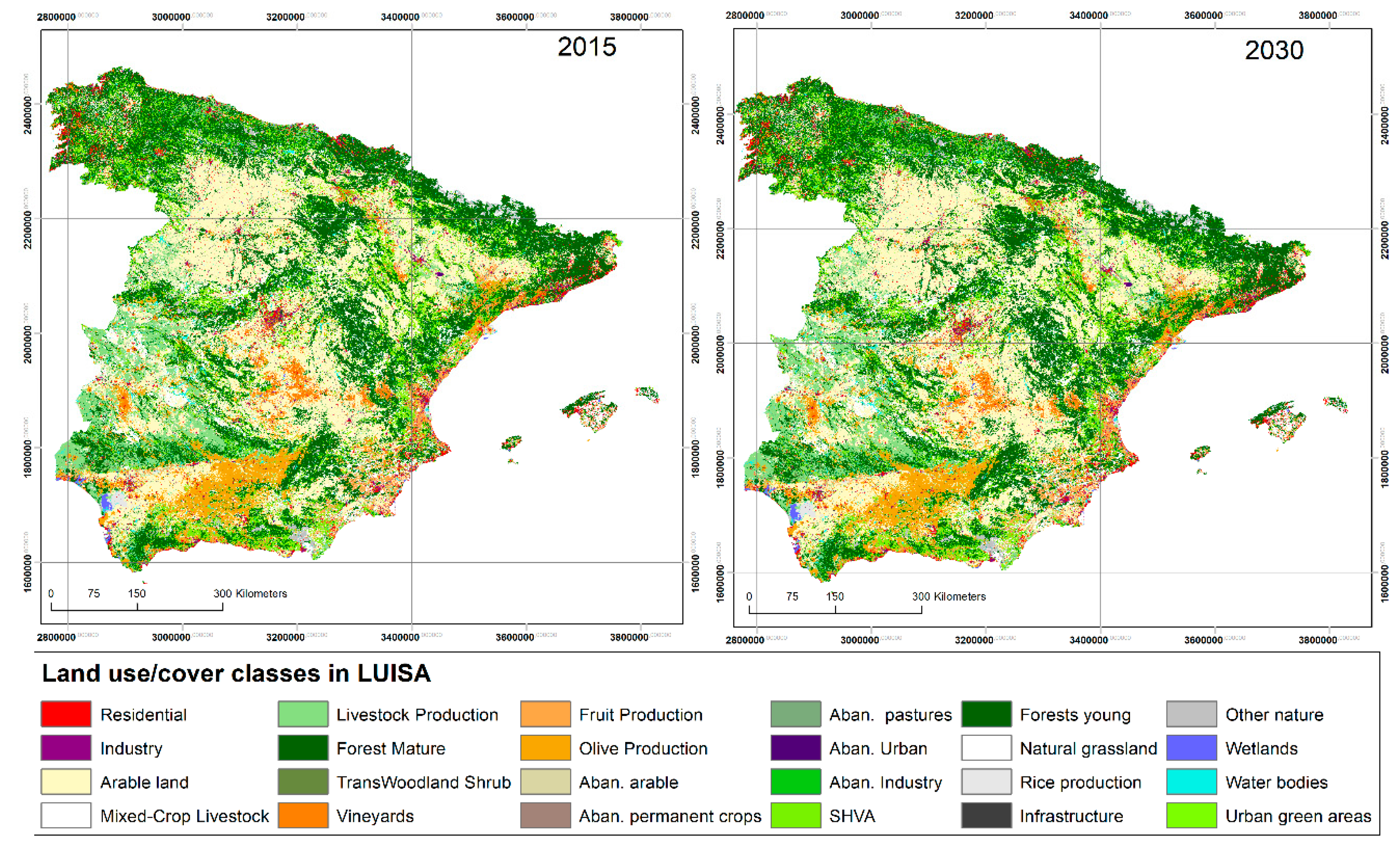
Here is the different ways
the land in Spain is being used.
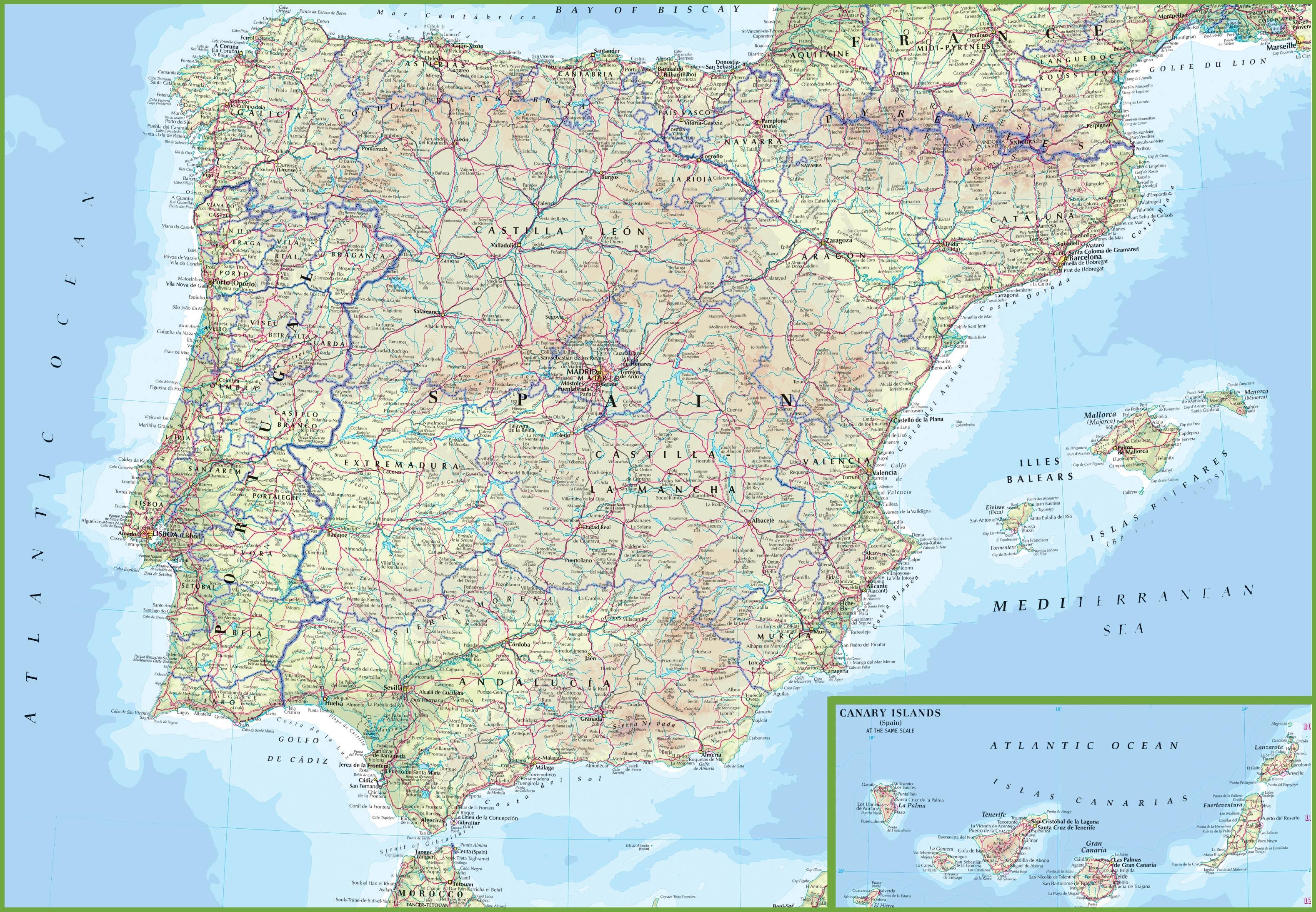
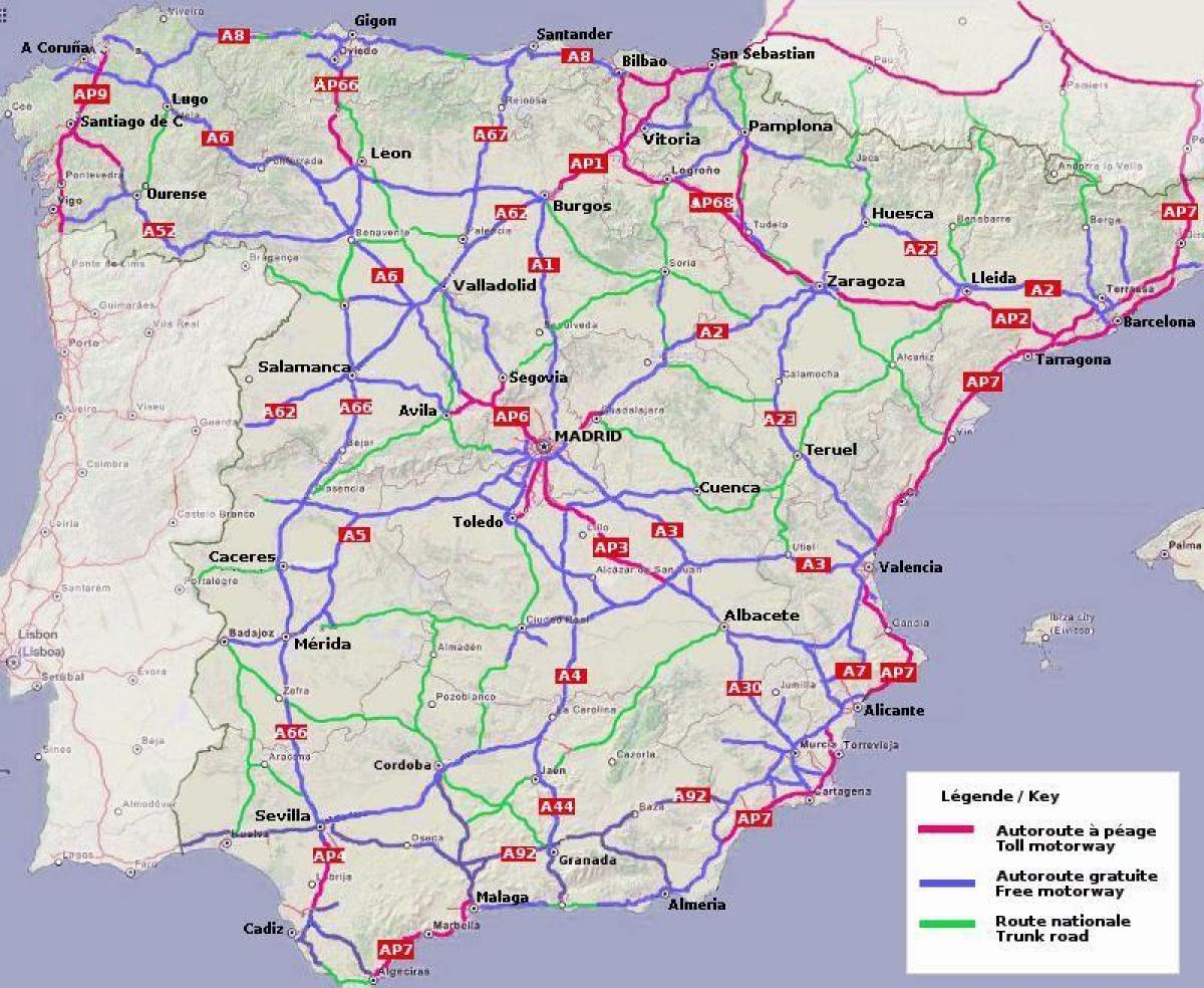
4 Road Maps
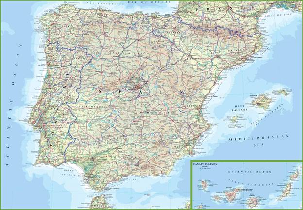
A general, country wide road
map.
https://spainmap360.com/img/0/spain-road-map.jpg
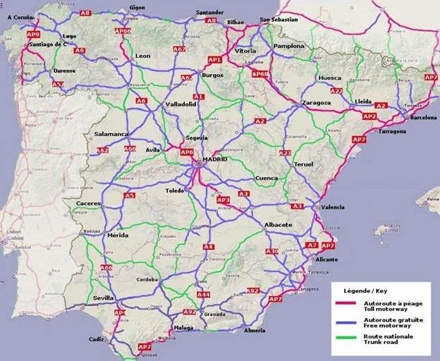
The main highways in Spain.
https://maps-spain.com/img/1200/spain-highway-map.jpg
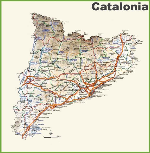
Roads in Catalonia, a region
of Spain.
https://ontheworldmap.com/spain/autonomous-community/catalonia/catalonia-road-map.jpg
5 City Maps
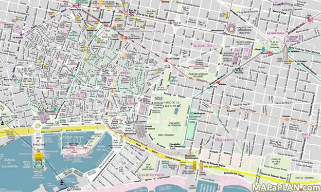
Barcelona, Spain
https://i.pinimg.com/originals/f0/33/0b/f0330b98ab9c56dbad3e22ad0b994df4.jpg
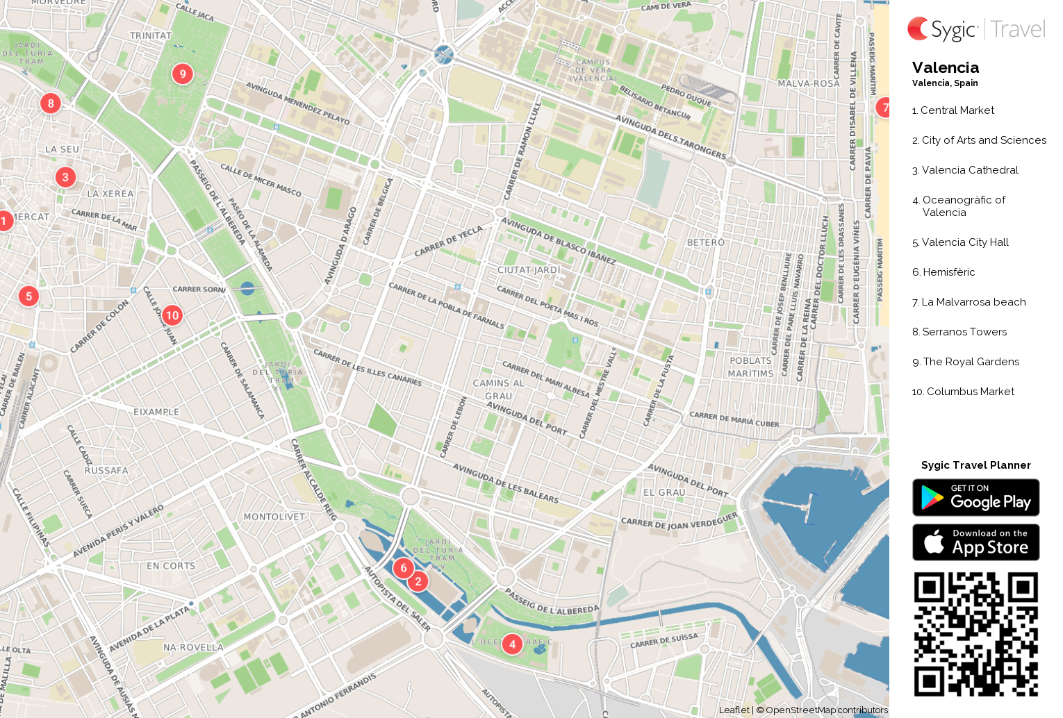
Madrid, Spain

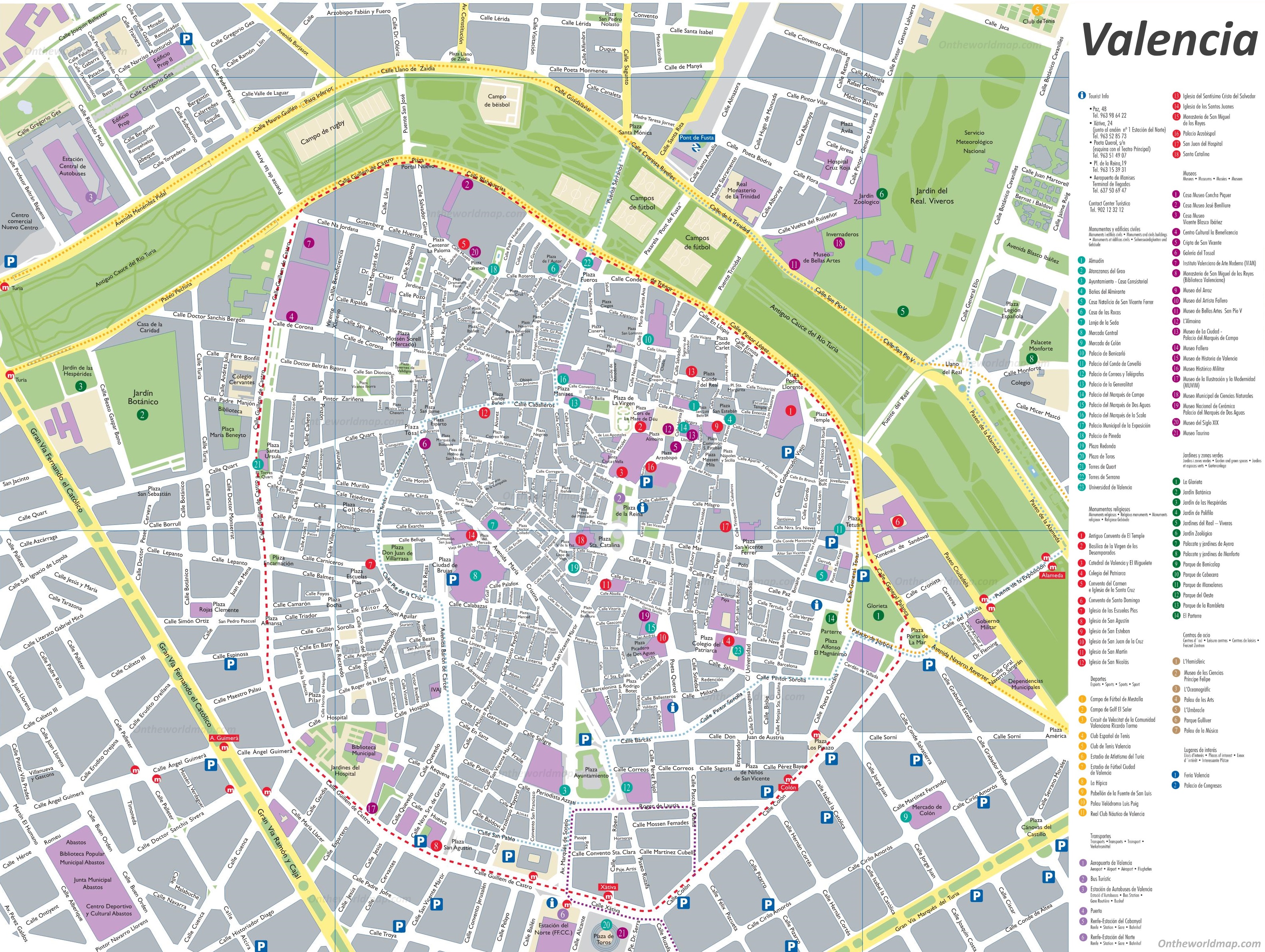
Valencia, Spain
6 Urban
Transportation
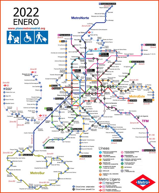
Madrid metro map from 2022
showing which stations are handicap accessible.
https://www.planometromadrid.org/mapas-metro/plano-metro-madrid-accesible-2022-01.png

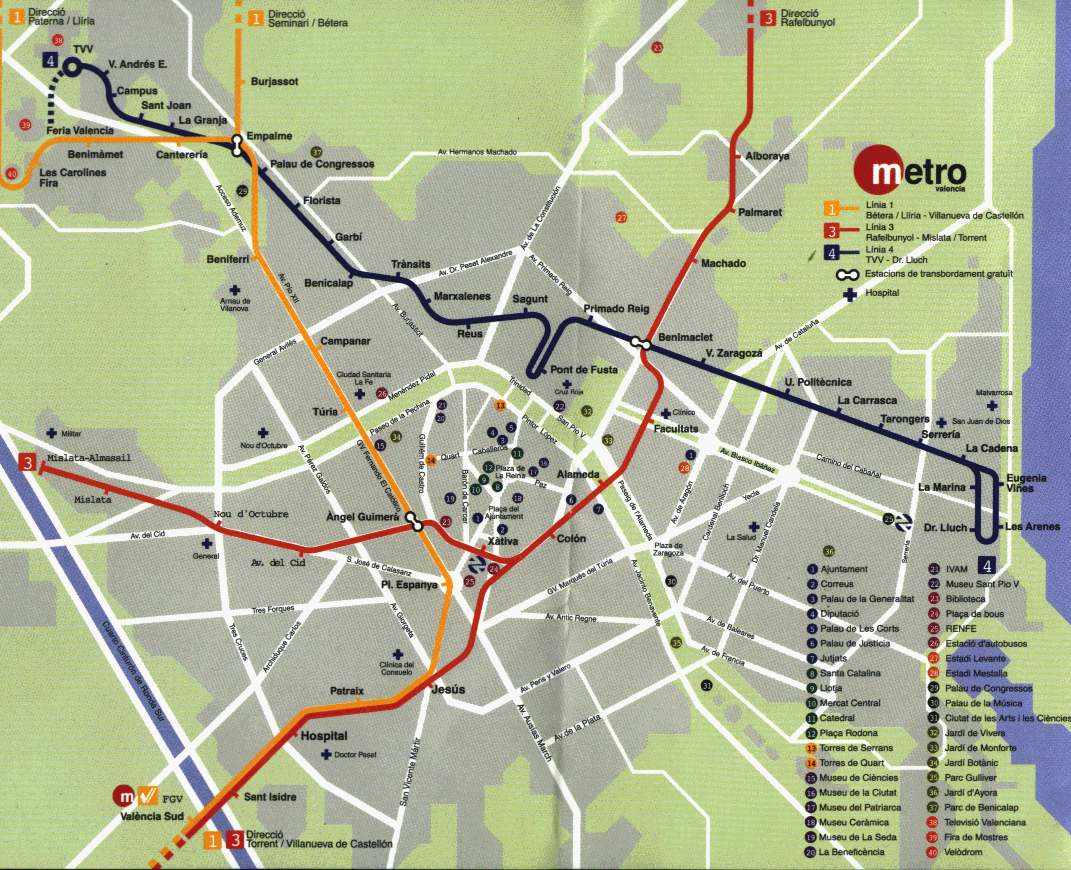
Valencia public
transportation.
https://www.gifex.com/images/0X0/2011-01-17-12783/Valencia_Metro.gif
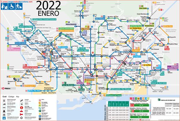
Transportation map of
Barcelona.
https://www.mapametrobarcelona.com/mapas-metro/mapa-metro-barcelona-accesibilidad-2022.png
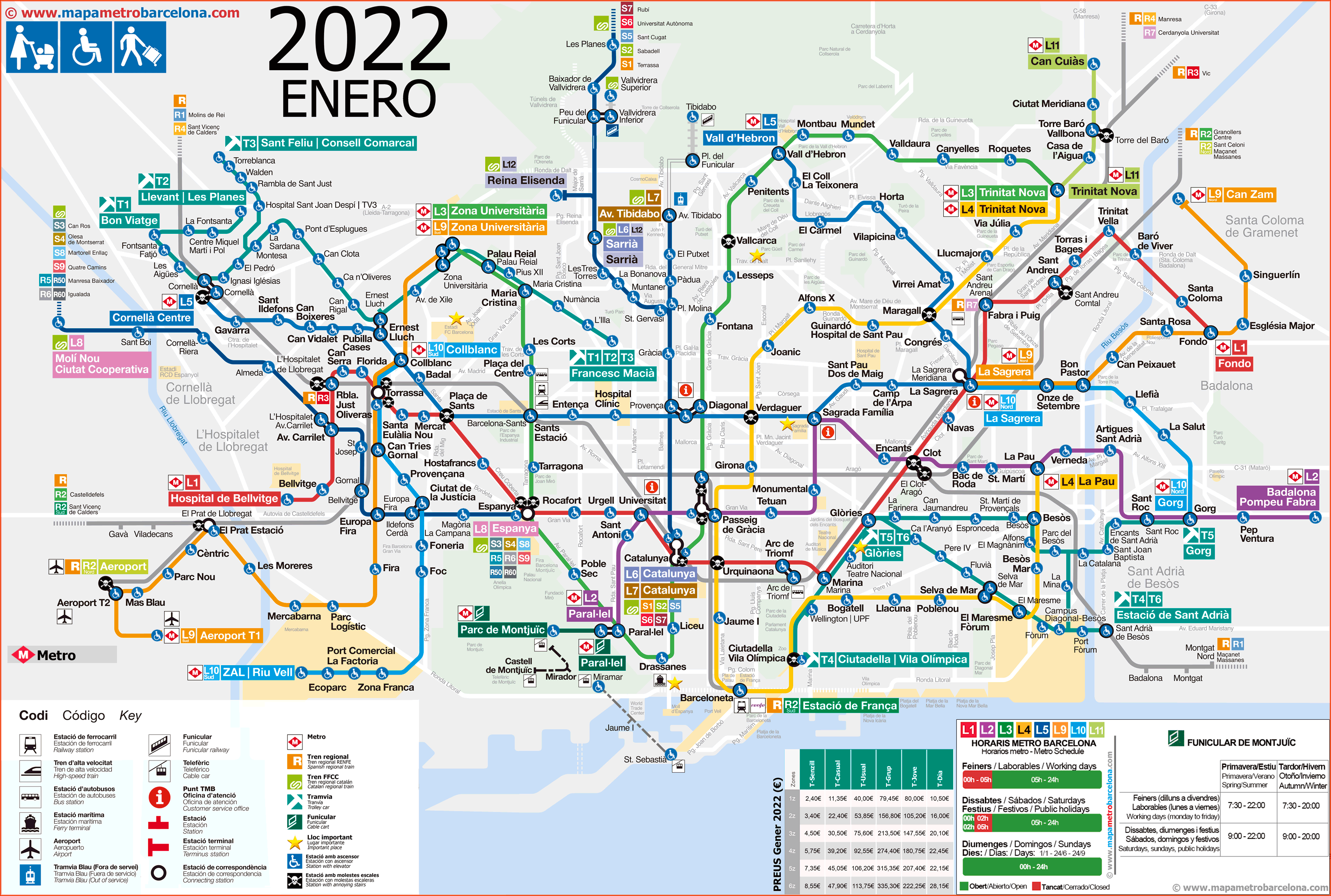
7 Tourist Sites
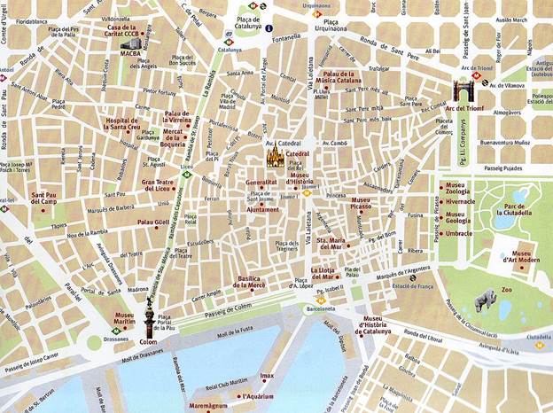
Barcelona, Spain
https://www.gifex.com/images/0X0/2011-01-25-12840/Barcelona_tourist_map.jpg
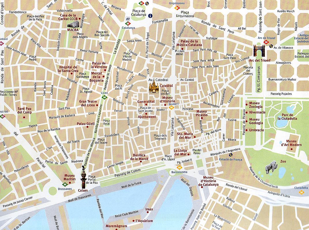
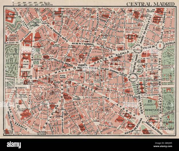
Madrid, Spain
https://c8.alamy.com/comp/GBKJW5/central-madrid-vintage-town-city-map-plan-spain-1930-GBKJW5.jpg
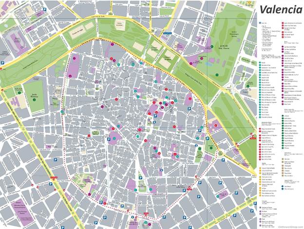
Valencia, Spain
https://ontheworldmap.com/spain/city/valencia/valencia-old-town-map-with-sightseeings.jpg
8 Map from Travel
Book
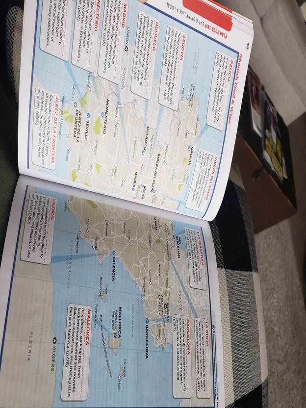
I
decided on Lonely Planet’s book for Spain, and this is a map inside depicting
different food that is popular in various places.
Submitted
by [Rebekah Plummer] on [3/12/22].